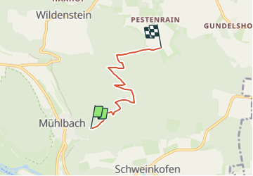
![](/images/other/stat-length.png)
![Randonnée A pied Dietfurt an der Altmühl - Jurasteig Höhlenkundliche Schlaufe - Photo](https://media.geolcdn.com/t/1900/400/0f70a6da-31b6-4eb2-8e53-6117b8cf15c2.jpeg&format=pjpeg&maxdim=2)
Jurasteig Höhlenkundliche Schlaufe
SityTrail - itinéraires balisés pédestres
Tous les sentiers balisés d’Europe GUIDE+
![Longueur](/images/other/stat-length.png)
![Altitude max](https://static1.geolcdn.com/siteimages/upload/files/1508320355ic_sort_altitude_max_24dp.png)
![Dénivelé positif](https://static1.geolcdn.com/siteimages/upload/files/1508320355ic_sort_den_pos_24dp.png)
![Km-Effort](/images/other/stat-length.png)
![Altitude min](https://static1.geolcdn.com/siteimages/upload/files/1508320355ic_sort_altitude_min_24dp.png)
![Dénivelé négatif](https://static1.geolcdn.com/siteimages/upload/files/1508320355ic_sort_den_neg_24dp.png)
![Boucle](https://static1.geolcdn.com/siteimages/upload/files/16400158638029165_repeat_loop_refresh_sync_direction_icon.png)
![A pied](https://static1.geolcdn.com/sitytour/trail-icons/100.png)
1h02
Difficulté : Facile
![Scannez ce code QR pour ouvrir la randonnée dans l'application SityTrail](https://capi.geolives.com/qq0zvz2zws4bq2lad0pu/sitytour/trails/3091916/qr.png?size=200)
Application GPS de randonnée GRATUITE
À propos
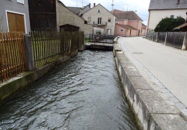
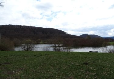
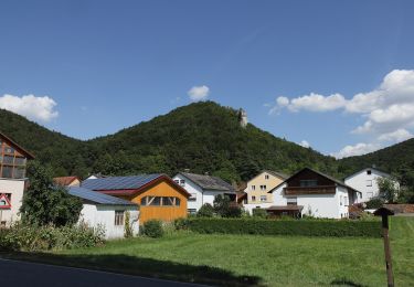
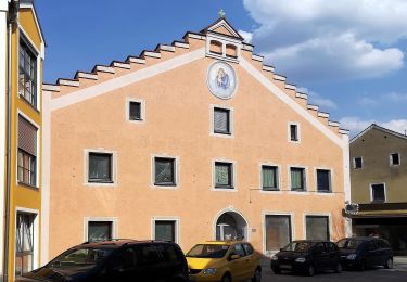
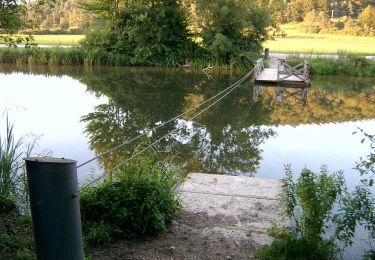
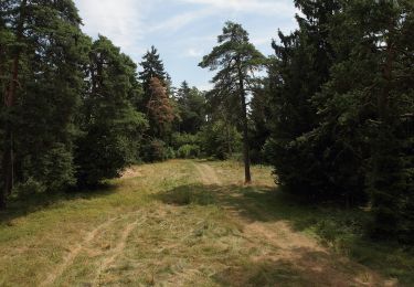
Randonnée A pied de 3,8 km à découvrir à Bavière, Landkreis Neumarkt in der Oberpfalz, Dietfurt an der Altmühl. Cette randonnée est proposée par SityTrail - itinéraires balisés pédestres.
Description
Randonnée créée par Gebietsgemeinschaft Bayerischer Jura.
geprüft (März 2104, by cycling_zno)
Symbole: Gelbe Schleife auf blauem Grund
Localisation
Commentaires
Randonnées à proximité
![Randonnée A pied Dietfurt an der Altmühl - Dietfurter Wasserwege (Technik & Natur) - Photo](https://media.geolcdn.com/t/375/260/7fa80b07-24d7-49ad-92b8-2004a04c8b75.jpeg&format=jpg&maxdim=2)
![A pied A pied](https://static1.geolcdn.com/sitytour/trail-icons/100.png)
A pied
![](/images/other/stat-length.png)
![](https://static1.geolcdn.com/siteimages/upload/files/16400158638029165_repeat_loop_refresh_sync_direction_icon.png)
![Randonnée A pied Dietfurt an der Altmühl - Dietfurter Wasserwege (Zurück zur Quelle) - Photo](https://media.geolcdn.com/t/375/260/40261bff-4a38-444a-b7b0-328635d3bc0e.jpeg&format=jpg&maxdim=2)
![A pied A pied](https://static1.geolcdn.com/sitytour/trail-icons/100.png)
A pied
![](/images/other/stat-length.png)
![](https://static1.geolcdn.com/siteimages/upload/files/16400158638029165_repeat_loop_refresh_sync_direction_icon.png)
![Randonnée A pied Dietfurt an der Altmühl - Dietfurter Wasserwege (Stadtspaziergang) - Photo](https://media.geolcdn.com/t/375/260/862dc7cb-c5b9-40c3-91cf-087ccb2e4660.jpeg&format=jpg&maxdim=2)
![A pied A pied](https://static1.geolcdn.com/sitytour/trail-icons/100.png)
A pied
![](/images/other/stat-length.png)
![](https://static1.geolcdn.com/siteimages/upload/files/16400158638029165_repeat_loop_refresh_sync_direction_icon.png)
![Randonnée A pied Dietfurt an der Altmühl - QiGong-Weg - Photo](https://media.geolcdn.com/t/375/260/8a4e5930-d498-4004-bf3d-ec18db1eb5a0.jpeg&format=jpg&maxdim=2)
![A pied A pied](https://static1.geolcdn.com/sitytour/trail-icons/100.png)
A pied
![](/images/other/stat-length.png)
![](https://static1.geolcdn.com/siteimages/upload/files/16400158638029165_repeat_loop_refresh_sync_direction_icon.png)
![Randonnée A pied Dietfurt an der Altmühl - Wildensteiner Steig - Photo](https://media.geolcdn.com/t/375/260/837f69fb-dc78-4893-9844-6bb2e70098cf.jpeg&format=jpg&maxdim=2)
![A pied A pied](https://static1.geolcdn.com/sitytour/trail-icons/100.png)
A pied
![](/images/other/stat-length.png)
![](https://static1.geolcdn.com/siteimages/upload/files/16400158638029165_repeat_loop_refresh_sync_direction_icon.png)
![Randonnée A pied Dietfurt an der Altmühl - Walderlebnispfad Wolfsberg - Photo](https://media.geolcdn.com/t/375/260/cc3bc6e1-b2fc-4048-994a-81e61f02ba18.jpeg&format=jpg&maxdim=2)
![A pied A pied](https://static1.geolcdn.com/sitytour/trail-icons/100.png)
A pied
![](/images/other/stat-length.png)
![](https://static1.geolcdn.com/siteimages/upload/files/16400158638029165_repeat_loop_refresh_sync_direction_icon.png)
![Randonnée A pied Dietfurt an der Altmühl - Altmühlbergweg - Photo](https://media.geolcdn.com/t/375/260/9fca1159-7b87-46e1-9972-29b961fbe478.jpeg&format=jpg&maxdim=2)
![A pied A pied](https://static1.geolcdn.com/sitytour/trail-icons/100.png)
A pied
![](/images/other/stat-length.png)
![](https://static1.geolcdn.com/siteimages/upload/files/16400158638029165_repeat_loop_refresh_sync_direction_icon.png)
![Randonnée A pied Dietfurt an der Altmühl - Kreuzbergweg - Photo](https://media.geolcdn.com/t/375/260/6bb03e6d-2967-4549-a4ef-e5766f5a4c8c.jpeg&format=jpg&maxdim=2)
![A pied A pied](https://static1.geolcdn.com/sitytour/trail-icons/100.png)
A pied
![](/images/other/stat-length.png)
![](https://static1.geolcdn.com/siteimages/upload/files/16400158638029165_repeat_loop_refresh_sync_direction_icon.png)
![Randonnée A pied Dietfurt an der Altmühl - Jurasteig Tillyland-Schlaufe - Photo](https://media.geolcdn.com/t/375/260/cc3bc6e1-b2fc-4048-994a-81e61f02ba18.jpeg&format=jpg&maxdim=2)
![A pied A pied](https://static1.geolcdn.com/sitytour/trail-icons/100.png)
A pied
![](/images/other/stat-length.png)
![](https://static1.geolcdn.com/siteimages/upload/files/16400158638029165_repeat_loop_refresh_sync_direction_icon.png)